


Zustellung: Mo, 02.06. - Fr, 06.06.
Versand in 3 Wochen
VersandkostenfreiBestellen & in Filiale abholen:
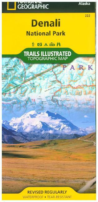
Karte mit neuen Wanderwegen und Campingplätzen
A necessity for exploring in the outdoors, Trails Illustrated topographic maps are detailed, up-to-date, and printed on waterproof, tear-resistant material. Denali National Park, in the Alaska Range, is crowned by Mount McKinley - America's highest peak at 20, 320 feet. The map includes the entire national park area, with a close-up view of the area in and around Mount McKinley. It also includes useful tips about animal encounters, river crossings, hypothermia, and UTM grids for use with your GPS unit.
Mehr aus dieser Reihe
![Great Smoky Mountains National Park [Map Pack Bundle]](/_next/image?url=https%3A%2F%2Fmedia2.hugendubel.de%2Fshop%2Fcoverscans%2F132%2F13219294_039350968_xl.jpg&w=3840&q=75)


![Pacific Crest Trail: San Gabriel and San Bernardino Mountains Map [Vasquez Rocks to San Gorgonio Pass]](/_next/image?url=https%3A%2F%2Fmedia2.hugendubel.de%2Fshop%2Fcoverscans%2F383%2F38327657_9781566957939_xl.jpg&w=3840&q=75)
![Pacific Crest Trail: Shasta and Lassen Map [Castle Crags to Sierra Buttes]](/_next/image?url=https%3A%2F%2Fmedia2.hugendubel.de%2Fshop%2Fcoverscans%2F383%2F38328370_9781566957892_xl.jpg&w=3840&q=75)
![Jasper North Map [Jasper National Park]](/_next/image?url=https%3A%2F%2Fmedia2.hugendubel.de%2Fshop%2Fcoverscans%2F185%2F18574686_18574686_xl.jpg&w=3840&q=75)
![Jasper South Map [Jasper National Park]](/_next/image?url=https%3A%2F%2Fmedia2.hugendubel.de%2Fshop%2Fcoverscans%2F185%2F18575703_9781566956604_xl.jpg&w=3840&q=75)
![Banff North Map [Banff and Yoho National Parks]](/_next/image?url=https%3A%2F%2Fmedia2.hugendubel.de%2Fshop%2Fcoverscans%2F185%2F18575700_18575700_xl.jpg&w=3840&q=75)
![Banff South Map [Banff and Kootenay National Parks]](/_next/image?url=https%3A%2F%2Fmedia2.hugendubel.de%2Fshop%2Fcoverscans%2F185%2F18574685_18574685_xl.jpg&w=3840&q=75)


![Grand Canyon West Map [Grand Canyon National Park]](/_next/image?url=https%3A%2F%2Fmedia2.hugendubel.de%2Fshop%2Fcoverscans%2F132%2F13218994_13218994_xl.jpg&w=3840&q=75)
![Grand Canyon East Map [Grand Canyon National Park]](/_next/image?url=https%3A%2F%2Fmedia2.hugendubel.de%2Fshop%2Fcoverscans%2F132%2F13219034_9781566954945_xl.jpg&w=3840&q=75)
![Grand Canyon, North and South Rims Map [Grand Canyon National Park]](/_next/image?url=https%3A%2F%2Fmedia2.hugendubel.de%2Fshop%2Fcoverscans%2F126%2F12641009_12641009_xl.jpg&w=3840&q=75)


Produktdetails
Erscheinungsdatum
01. Januar 2023
Sprache
englisch
Auflage
2023rd edition
Seitenanzahl
2
Reihe
National Geographic Trails, 222
Autor/Autorin
National Geographic Maps - Trails Illustrated
Verlag/Hersteller
Produktart
Blätter und Karten
Gewicht
89 g
Größe (L/B/H)
237/111/9 mm
Sonstiges
Polychrome print. Folded
ISBN
9781566953283
Bewertungen
0 Bewertungen
Es wurden noch keine Bewertungen abgegeben. Schreiben Sie die erste Bewertung zu "Denali National Park and Preserve Map" und helfen Sie damit anderen bei der Kaufentscheidung.