Bücher versandkostenfrei*100 Tage RückgaberechtAbholung in der Wunschfiliale


Zustellung: Di, 27.05. - Fr, 30.05.
Sofort lieferbar
VersandkostenfreiBestellen & in Filiale abholen:
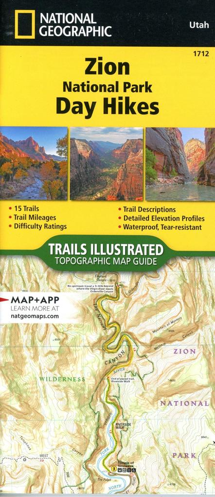
- Waterproof - Tear-Resistant - Topographic Map
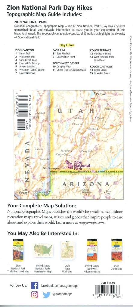
Zion was officially established as a national park in 1919. One of only two scenic rivers in Utah runs through the park, and over 84% of the park's land is designated as wilderness. Visitors can experience a variety of activities in the park from front-country camping and biking on roadways, to wilderness hiking, backpacking, canyoneering, river trips, and stargazing. The park ranges in elevation from 3,666 to 8,726 feet and supports a wide assortment of plants and animal life like ponderosa pines and desert reptiles.
The Zion National Park Day Hikes Topographic Map Guide contains detailed maps for 15 of Zion's finest day hikes. It includes well-known hikes and some off-the-beaten-path trails. They range from easy strolls to strenuous climbs, selected to give you a sampling of all the park has to offer. Together, they cover almost 100 miles of adventures. One-third of the selected hikes are less than 4 miles long, two-thirds are less than 7 miles, and two hikes are longer than 11 miles long.
Each of the 15 maps include directions to the trailhead, the total distance to complete the hike, and an estimate of the degree of difficulty. Also provided are elevations of key points on the trail, an elevation profile for the hike, and a calculation of the hike's total elevation gain. Concise trail descriptions will help you find the hikes that best suit your interests, conditioning, and available time.
Every Trails Illustrated map is printed on "Backcountry Tough" waterproof, tear-resistant paper. A full UTM grid is printed on the map to aid with GPS navigation. Every map purchase helps support the National Geographic Society, an impact driven, nonprofit organization with global reach that uses the power of science, exploration, education, and storytelling to illuminate and protect the wonder of our world.
- Map Scale = 1:31,680
- Folded Size = 4.25" x 9.38"
Mehr aus dieser Reihe


Produktdetails
Erscheinungsdatum
31. Mai 2023
Sprache
englisch
Auflage
2023rd edition
Seitenanzahl
44
Reihe
NGS National Parks US
Autor/Autorin
National Geographic Maps - Trails Illustrated
Verlag/Hersteller
Produktart
Blätter und Karten
Gewicht
85 g
Größe (L/B/H)
236/110/7 mm
ISBN
9781566959087
Bewertungen
0 Bewertungen
Es wurden noch keine Bewertungen abgegeben. Schreiben Sie die erste Bewertung zu "Zion National Park Day Hikes Map" und helfen Sie damit anderen bei der Kaufentscheidung.