Bücher versandkostenfrei*100 Tage RückgaberechtAbholung in der Wunschfiliale


Unser Geschenk zum Sommeranfang: 15% Rabatt11 auf Spielwaren mit dem Code SONNE15
Jetzt einlösen
mehr erfahren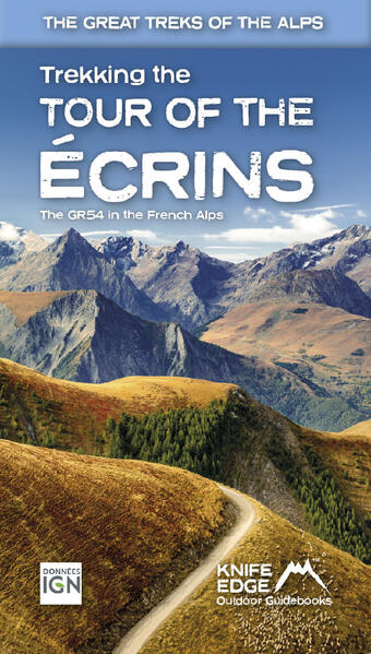
Zustellung: Do, 10.07. - Di, 15.07.
Versand in 2 Wochen
VersandkostenfreiBestellen & in Filiale abholen:
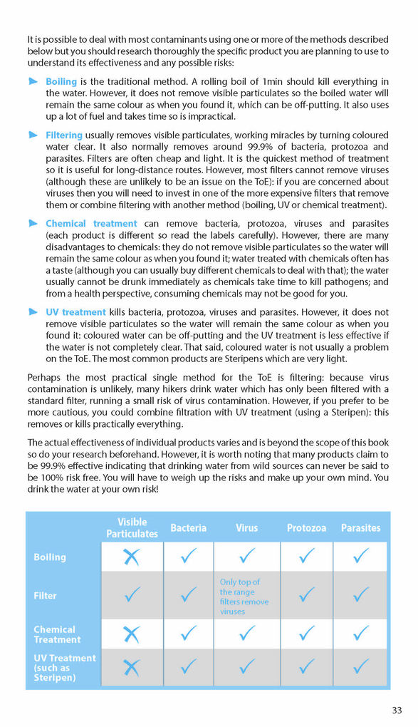
The only English language guidebook for the GR54 has been completely rewritten and fully updated for 2024.
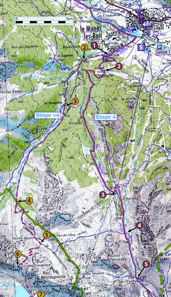
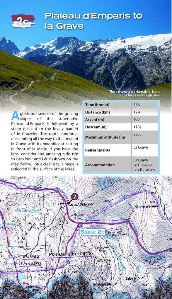
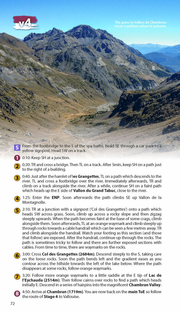
- Real 1:25, 000 Maps: IGN mapping included for each stage. This makes navigation easy and saves you money: no need to buy additional maps.
Also includes:
- Unique Itinerary Planner: plan a bespoke itinerary to match your ability and vacation schedule. All difficult calculations of time, distance and altitude gain are done for you
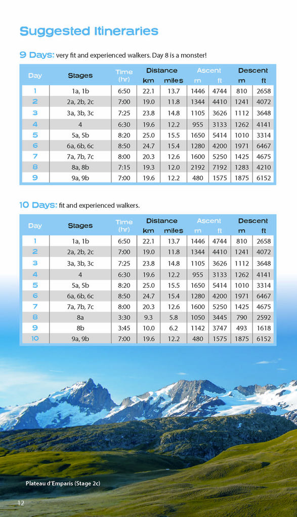
- 4 Proposed Itineraries of between 9 and 12 days
- Detailed information on equipment and travelling light
- Everything the trekker needs to know to plan the route: route descriptions, costs, budget, difficulty, weather, how to get there, and more
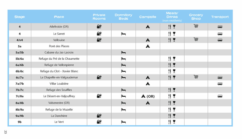
- Full accommodation listings: spectacularly situated mountain huts, villages, hamlets and campsites
- Essential travel information
- Information for both self-guided and guided trekkers
- Numbered waypoints linking the Real Maps to our clear descriptions
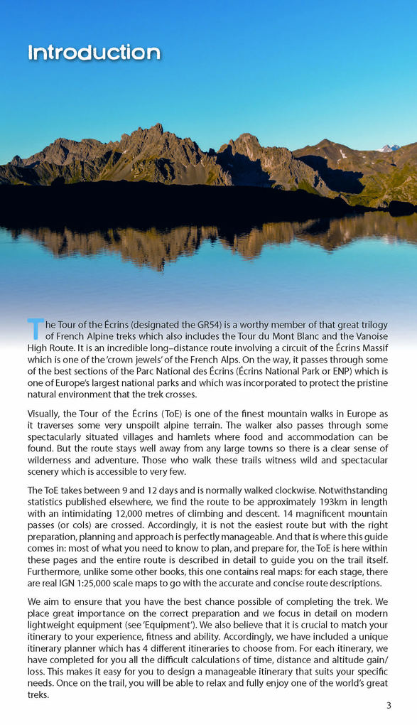
The GR54: Tour of the Ecrins National Park is arguably the finest trek in the Alps. It is an epic journey around the unforgettable Écrins which has the highest mountains in the French Alps outside of the Mont Blanc Massif. This is one of France' s ' crown jewels' and yet is hardly known to the English-speaking world.
- 193km
- 9-12 days
- 12, 000m of altitude gain
- 14 mountain passes
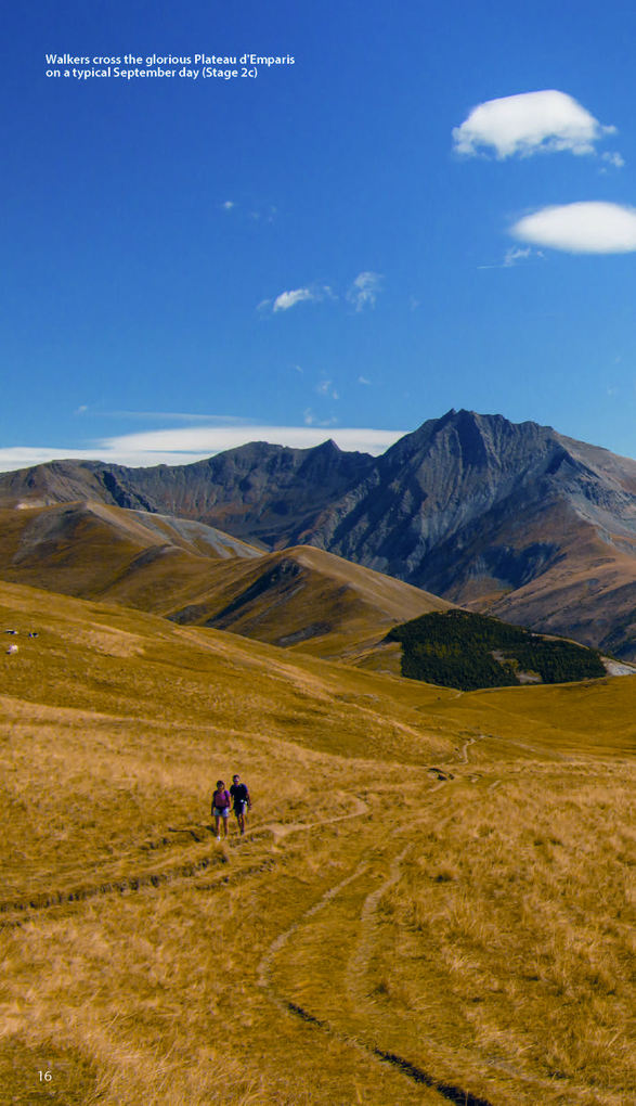
Unspoilt and remote high mountain terrain: snow frosted summits, beautiful valleys and pastures, sparkling azure lakes, carpets of wild flowers, the soothing sound of cow bells and easy to follow paths. This trek should be on your hiking bucket list.
Warnhinweise
Dieser Hinweis kann lt. Artikel 9 Absatz 7 Satz 2 der GPSR entfallen, da das Produkt auch ohne Anweisungen und Sicherheitsinformationen sicher und wie vom Hersteller vorgesehen verwendet werden kann.
Mehr aus dieser Reihe


Produktdetails
Erscheinungsdatum
01. Mai 2024
Sprache
englisch
Auflage
2nd Revised edition
Seitenanzahl
116
Reihe
Knife Edge guidebooks
Autor/Autorin
Andrew McCluggage
Verlag/Hersteller
Produktart
kartoniert
Gewicht
210 g
Größe (L/B/H)
205/123/10 mm
ISBN
9781912933600
Entdecken Sie mehr
Bewertungen
0 Bewertungen
Es wurden noch keine Bewertungen abgegeben. Schreiben Sie die erste Bewertung zu "Tour of the Ecrins National Park (Gr54): Real Ign Maps 1:25,000" und helfen Sie damit anderen bei der Kaufentscheidung.